Matterport Services
Matterport Virtual Tours
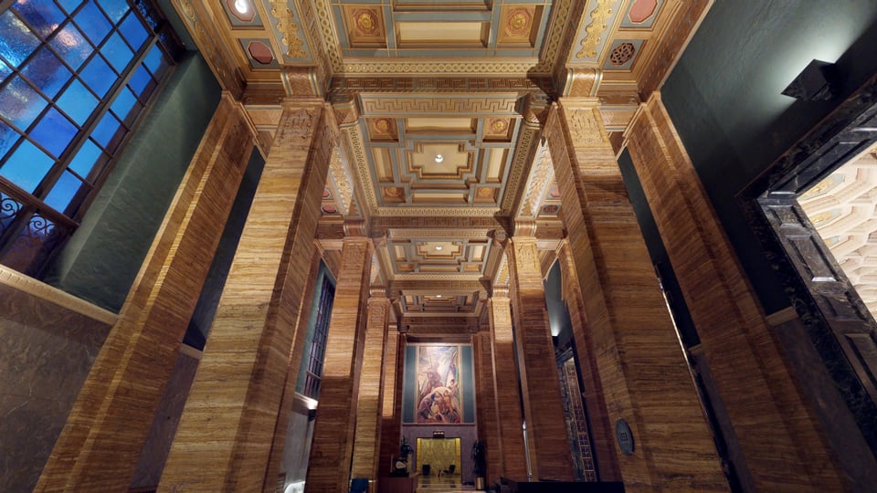
Miro3D creates virtual tours and digital twin solutions using Matterport 3D technology—so you can modify, manage and market a 3D virtual space from anywhere! Miro3D is a Houston top-rated Matterport 3D Virtual Tour Provider, now expanding nationwide. Whether you’re into real estate, architecture, engineering, construction, insurance and restoration, or site surveying—visualizing details about the structure around you is vital.
Create a virtual tour of your facility and immerse your clients in a 3D walkthrough! Miro3D will save you the time and money it takes to travel to a site with an efficient and accurate digital twin of your residential site, retail store, rental property, office, multi-family building, construction site or survey site. We’ve streamlined the process for you, using professional Matterport 3D cameras like the BLK360 and others.
IMatterport Point Cloud Data:
A point cloud is a set of data points within a three-dimensional coordinate system, positioned on X, Y, and Z axes. This data can be collected with a 3D scan and represents the external surface of an environment. Miro3D scanning services will take millions of measurements and collect information about your built environment to be processed and assembled into a point cloud.
Using the Matterport Pro3 or other laser scanners such as the Leica BLK 360, we’ll capture your large scale space and deliver precise point cloud data. With E57 point clouds, you’ll get 10 times the detail and a vendor-neutral file, integratable into most 3D software.


3D Laser Scan to BIM Files
Complete your projects faster, reduce errors and increase collaboration with scan to BIM data. Using Matterport cameras, Miro3D will conduct a 3D scan of the most complex facilities, and turn it into an accurate representation of a space that can be accessed anywhere.
Whether you’re an architect, engineer or construction professional—streamline your building cycle with a shareable scan to BIM file. Go from tape measures and note pads to a completely automated documentation system. Avoid minor errors that can eventually cause serious problems with a highly accurate digital picture.We’ll take a Matterport 3D scan and transform it into BIM files for import into 3rd party programs like Revit, AutoCAD and more.
Matterport Virtual Tours
Miro3D creates virtual tours and digital twin solutions using Matterport 3D technology—so you can modify, manage and market a 3D virtual space from anywhere! Miro3D is a Houston top-rated Matterport 3D Virtual Tour Provider, now expanding nationwide. Whether you’re into real estate, architecture, engineering, construction, insurance and restoration, or site surveying—visualizing details about the structure around you is vital.
Create a virtual tour of your facility and immerse your clients in a 3D walkthrough! Miro3D will save you the time and money it takes to travel to a site with an efficient and accurate digital twin of your residential site, retail store, rental property, office, multi-family building, construction site or survey site. We’ve streamlined the process for you, using professional Matterport 3D cameras like the BLK360 and others.

Matterport Point Cloud Data:
A point cloud is a set of data points within a three-dimensional coordinate system, positioned on X, Y, and Z axes. This data can be collected with a 3D scan and represents the external surface of an environment. Miro3D scanning services will take millions of measurements and collect information about your built environment to be processed and assembled into a point cloud.
Using the Matterport Pro3 or other laser scanners such as the Leica BLK 360, we’ll capture your large scale space and deliver precise point cloud data. With E57 point clouds, you’ll get 10 times the detail and a vendor-neutral file, integratable into most 3D software.

3D Laser Scan to BIM Files
Complete your projects faster, reduce errors and increase collaboration with scan to BIM data. Using Matterport cameras, Miro3D will conduct a 3D scan of the most complex facilities, and turn it into an accurate representation of a space that can be accessed anywhere.
Whether you’re an architect, engineer or construction professional—streamline your building cycle with a shareable scan to BIM file. Go from tape measures and note pads to a completely automated documentation system. Avoid minor errors that can eventually cause serious problems with a highly accurate digital picture.We’ll take a Matterport 3D scan and transform it into BIM files for import into 3rd party programs like Revit, AutoCAD and more.
Labeled Floor Plans
Potential buyers love online floor plans, and there's no better company than Miro3D to help! Differentiate your properties and provide a key tool for remote decision makers from marketing to build-out. Floor plans help immensely when seeing a property on the web, and paired with a Virtual Tour it creates the perfect online presence.
We offer 2D and 3D floor plans along with 3D Walkthroughs, a 3D “dollhouse” and floorplan view. These floorplans can be shared anywhere from websites, social media, real estate and vacation rental sites.


Google Street View
Promote your business's visibility with a high-quality virtual tour that lets people experience your location before they arrive. Matterport can help you easily design, create, and publish your personalized virtual tour using Google Street View. Street View is a great way for your customers and guests to view your restaurant, bar, hotel, apartment complex, or other location online.
CAD Files for Architects, Engineers, Construction Professionals
Using Matterport 3D technology, allow Miro3D to provide survey-grade capture services for industrial spaces, outdoor spaces, construction sites, and more. Draft as-built models using CAD files from architectural scans for CAD software like ArchiCAD, AutoCAD, Revit, Sketchup 3DS Max and more. These Matterport scans can be used for design, plumbing, walkthroughs and more. Miro 3D will help you save time on as-built drawings, measuring, and eliminate manual photography.
Truplan for Xactimate Insurance Files
Close claims faster without the measuring and manual sketching. Miro 3D will eliminate the need for physical inspections with an accurate and thorough 3D model. Using Matterport technology, we’ll provide Xactimate compatible files (Truplan) so you can easily determine property value, estimate repair and rebuilding costs.
This 3D model allows you to make notes, updates and share links of 3D spaces with engineers, adjusters, builders and policyholders. Reduce your time in the field with an accurate 3D walkthrough to serve as the single source of information. Partner with Miro3D to speed up the claims process as we provide comprehensive loss documentation through a 3D scan.
Labeled Floor Plans
Potential buyers love online floor plans, and there's no better company than Miro3D to help! Differentiate your properties and provide a key tool for remote decision makers from marketing to build-out. Floor plans help immensely when seeing a property on the web, and paired with a Virtual Tour it creates the perfect online presence.
We offer 2D and 3D floor plans along with 3D Walkthroughs, a 3D “dollhouse” and floorplan view. These floorplans can be shared anywhere from websites, social media, real estate and vacation rental sites.


CAD Files for Architects, Engineers, Construction Professionals
Using Matterport 3D technology, allow Miro3D to provide survey-grade capture services for industrial spaces, outdoor spaces, construction sites, and more. Draft as-built models using CAD files from architectural scans for CAD software like ArchiCAD, AutoCAD, Revit, Sketchup 3DS Max and more. These Matterport scans can be used for design, plumbing, walkthroughs and more. Miro 3D will help you save time on as-built drawings, measuring, and eliminate manual photography.
Google Street View
Promote your business's visibility with a high-quality virtual tour that lets people experience your location before they arrive. Matterport can help you easily design, create, and publish your personalized virtual tour using Google Street View. Street View is a great way for your customers and guests to view your restaurant, bar, hotel, apartment complex, or other location online.
Truplan for Xactimate Insurance Files
Close claims faster without the measuring and manual sketching. Miro 3D will eliminate the need for physical inspections with an accurate and thorough 3D model. Using Matterport technology, we’ll provide Xactimate compatible files (Truplan) so you can easily determine property value, estimate repair and rebuilding costs.
This 3D model allows you to make notes, updates and share links of 3D spaces with engineers, adjusters, builders and policyholders. Reduce your time in the field with an accurate 3D walkthrough to serve as the single source of information. Partner with Miro3D to speed up the claims process as we provide comprehensive loss documentation through a 3D scan.

 ►
Explore 3D Space